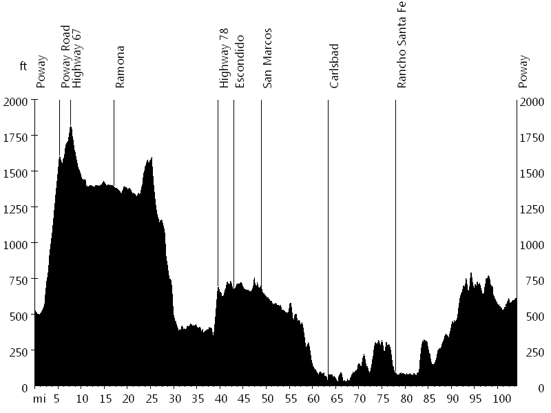
104 miles with 4,600 feet of climbing
Route Profile
Tour de Poway • Climbs
Tour de Poway • Description
The Tour de Poway is a scenic back country century in North County San Diego. The ride is laid out as a big loop, initially heading east, then north, west, south, and east again.
The ride starts with the biggest climb, Poway Road. After a short descent on Highway 67, the route visits Ramona, soon followed by a longer descent down Bandy Canyon. Highway 78 passes San Diego Wild Animal Park and leads up a short climb. The course then continues through the towns of Escondido and San Marcos, and passes Legoland on the way to Carlsbad.
For a while, the ride follows the Ocean, before heading inland again and eventually passing through Rancho Santa Fe. The bike path along Highway 56 gradually gains some elevation, and a few rolling hills lead back down to Poway.
Tour de Poway • Interactive Map
Tour de Poway • Pictures

Tour de Poway
Photo credit: Tour de Poway
By: Bernd Straehle
See Also: Gran Fondos & Centuries