101 miles with 13,100 feet of climbing
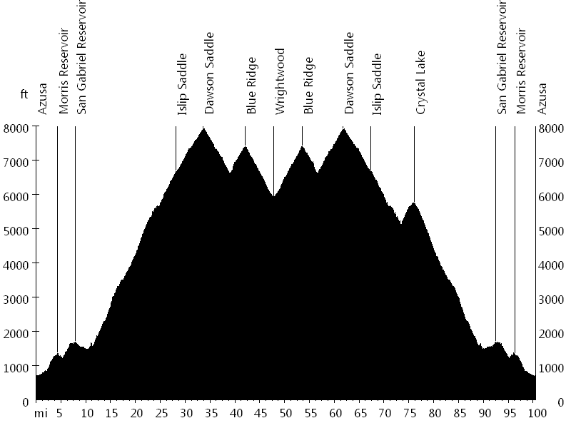
Route Profile
Dawson Saddle Traverse • Climbs
Dawson Saddle Traverse • Description
Dawson Saddle is the #1 paved climb in California in terms of elevation gain. San Gabriel Canyon Road (Highway 39) and Angeles Crest Highway lead up to the saddle. After Crystal Lake turnoff, Highway 39 is closed due to landslides, but it is in rideable condition (with a few short gravel sections).
Starting in Azusa, the ascent can be broken into different sections: Morris Reservoir (short descent here), San Gabriel Reservoir (short descent here), East Fork turnoff (1,500 feet), Crystal Lake turnoff (5,000 feet), Islip Saddle (6,600 feet), and Dawson Saddle (7,900 feet).
After Dawson Saddle, the route leads down to Vincent Gulch Divide, then it ascends to Blue Ridge (Inspiration Point), and then it descends again to Wrightwood, passing Big Pines. The way back is the same, with an optional out-and-back climb to Crystal Lake.
Dawson Saddle Traverse • Interactive Map
Dawson Saddle Traverse • Pictures
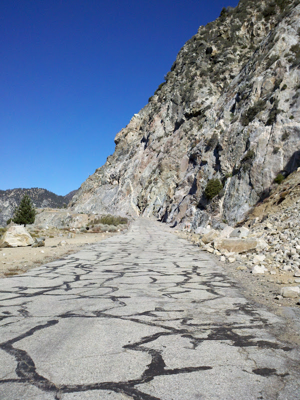
San Gabriel Canyon Road
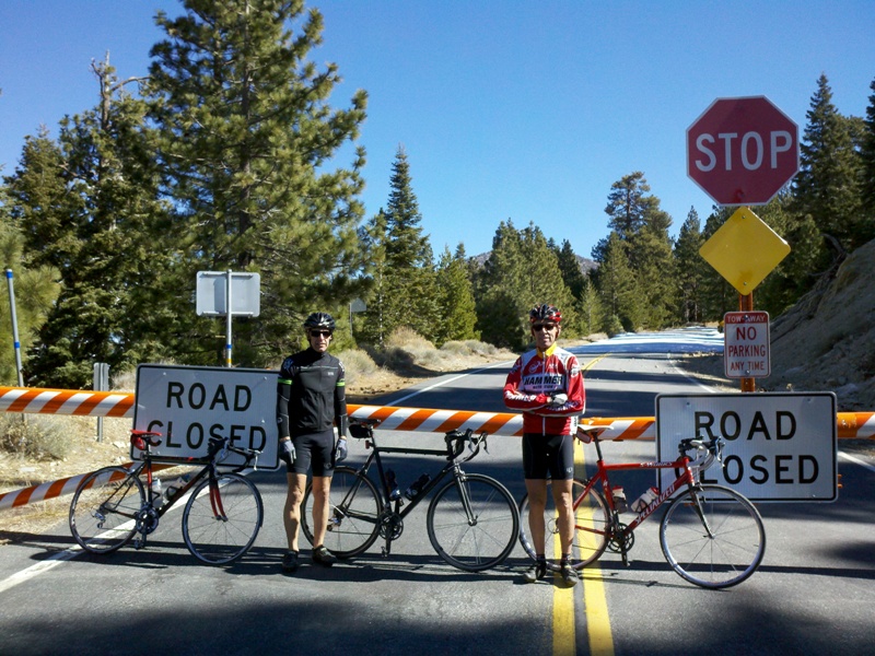
Islip Saddle

Angeles Crest Highway
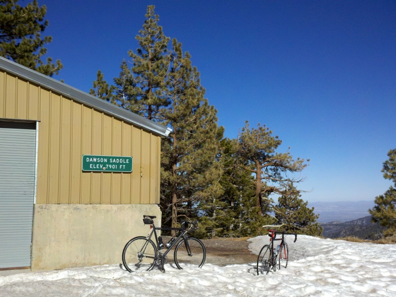
Dawson Saddle
By: Bernd Straehle
See Also: Gran Fondos & Centuries