200 miles with 30,200 feet of climbing
Horseshoe Meadows (46 miles with 7,400 feet of climbing)
Whitney Portal (25 miles with 4,800 feet of climbing)
Onion Valley (27 miles with 5,300 feet of climbing)
Lake Sabrina, North Lake, and South Lake (51 miles with 7,200 feet of climbing)
Tioga Pass and Saddlebag Lake (48 miles with 5,500 feet of climbing)
The Eastern Sierra is road bike climbing paradise. No other region in America offers as many major climbs in such close proximity.
All of the following climbs are top bike climbs in California and some are top bike climbs in America, either for most difficult climb, greatest elevation gained, or highest elevation attained.
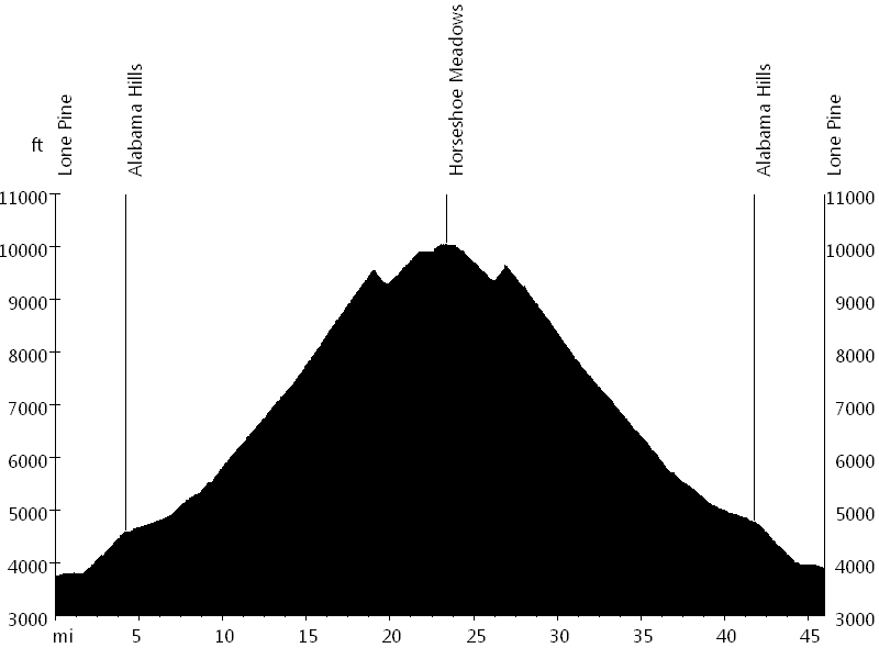
Route Profile • Horseshoe Meadows
HC: Mile 0
Cat. 3: Mile 20
Cat. 4: Mile 26
Horseshoe Meadows is the climb with the giant switchbacks, which can be seen from Highway 395. Horseshoe Meadows and Whitney Portal (and Onion Valley) can be combined into a single ride, which is best done when the temperature is not too hot.

Route Profile • Whitney Portal
Cat. 1: Mile 0
Whitney Portal is the climb that leads to the trailhead of Mount Whitney, at 14,497 feet the highest peak in the lower 48 states. Horseshoe Meadows and Whitney Portal (and Onion Valley) can be combined into a single ride, which is best done when the temperature is not too hot.
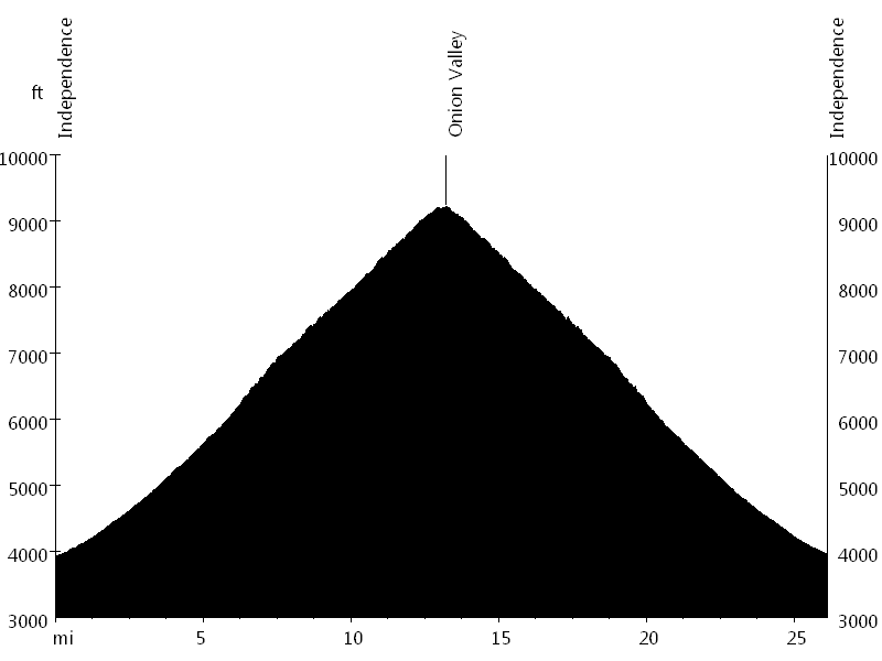
Route Profile • Onion Valley
HC: Mile 0
Onion Valley is one of the most interesting climbs in terms of changing views, including two sections of switchbacks.
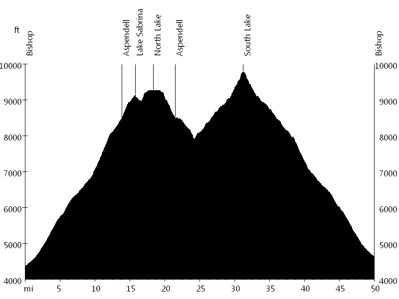
Route Profile • Lake Sabrina, North Lake, and South Lake
Cat. 1: Mile 0
Cat. 2: Mile 24
Cat. 4: Mile 17
Lake Sabrina, North Lake, and South Lake share Highway 168 for most of the climb. Highway 168 continues towards Lake Sabrina (single lane road at the end) and North Lake (gravel road at the end). South Lake is one of the climbs of the Everest Challenge (single lane towards the end).
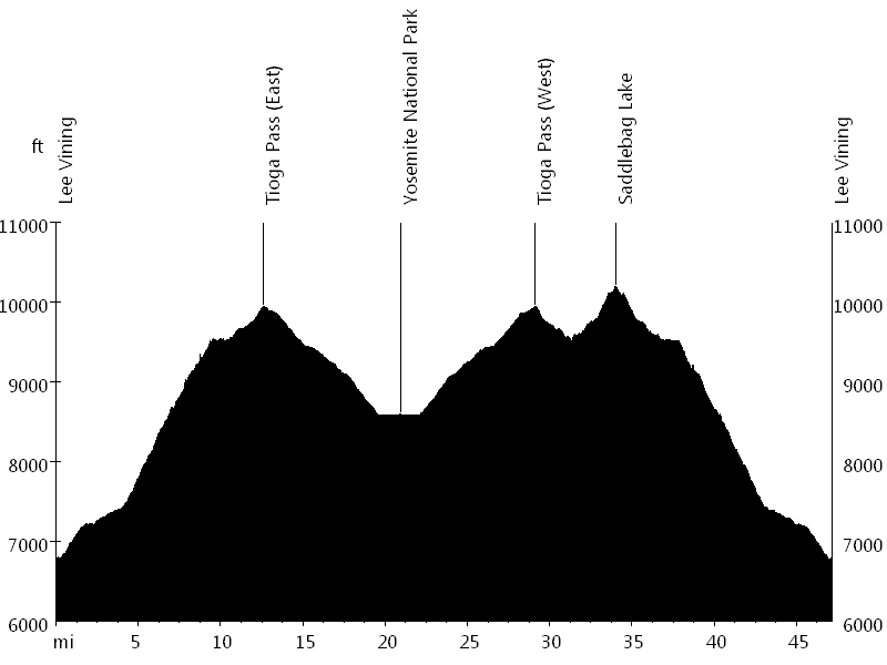
Route Profile • Tioga Pass and Saddlebag Lake
Cat. 1: Mile 0
Cat. 3: Mile 22 and 32
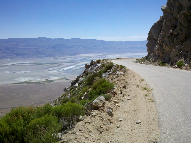
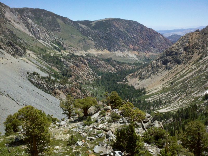
Tioga Pass East and West are the climbs with the most spectacular scenery. At the top of the pass is an entrance to Yosemite National Park (fee). Saddlebag Lake is a climb off Tioga Pass East (gravel road), which tops out at 10,200 feet.
Eastern Sierra • Interactive Map
Eastern Sierra • Pictures
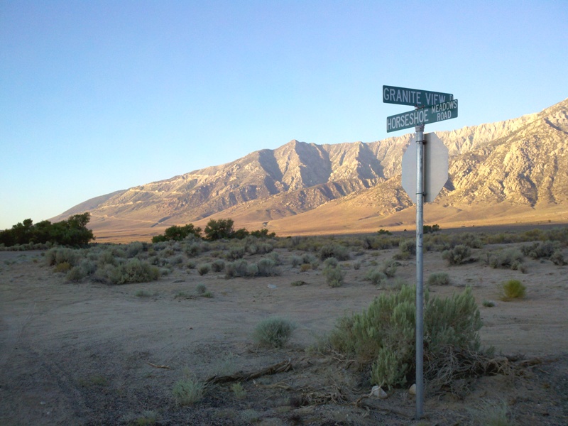
Horseshoe Meadows Road
Horseshoe Meadows Road
Horseshoe Meadows

Whitney Portal Road

Whitney Portal Road

Whitney Portal

Onion Valley Road
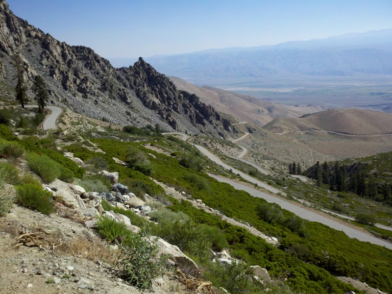
Onion Valley Road

Onion Valley
Tioga Pass East

Tioga Pass East

Ellery Lake
By: Bernd Straehle
See Also: Multi-Day Rides