125 miles with 16,300 feet of climbing
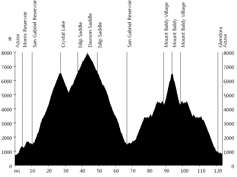
Route Profile
Dawson Saddle and Mount Baldy • Climbs
Dawson Saddle and Mount Baldy • Description
This ride is a variation of the Mount Baldy and Islip Saddle century and of the Mount Baldy Notch and Crystal Lake multi-surface century.
It starts in Azusa and initially leads up to the Crystal Lake area. After the store, the road continues single lane to Deer Flats campground (6,400 ft).
The ride continues on San Gabriel Canyon Road to Islip Saddle (6,600 ft) and on Angeles Crest Highway to Dawson Saddle (7,900 ft).
After a very long descent, East Fork Road leads to Glendora Mountain Road, Glendora Ridge Road, and Mount Baldy Road, the switchbacks up Mount Baldy (6,600 ft).
The descent follows the same route, but instead of turning onto East Fork Road, it continues on to Glendora and leads back to Azusa.
Dawson Saddle and Mount Baldy • Interactive Map
Dawson Saddle and Mount Baldy • Pictures
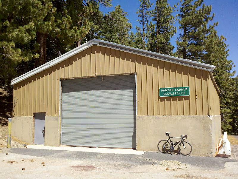
Dawson Saddle
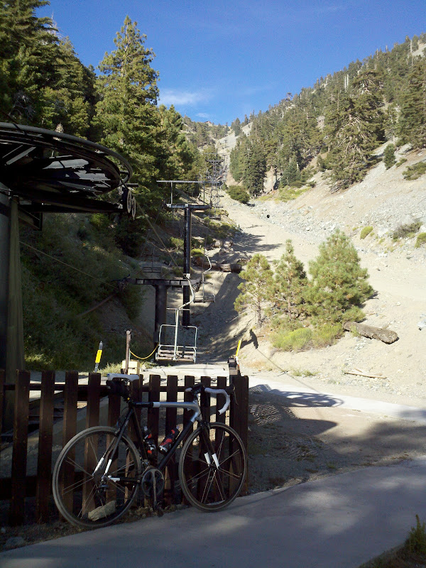
Mount Baldy
By: Bernd Straehle
See Also: Super Centuries