Summit elevation: 14,154 feet
Approach: 20 mi round-trip with 5,500 ft of climbing
Climb: 6 pitches of 5.7 difficulty
Mount Sill, Swiss Arête
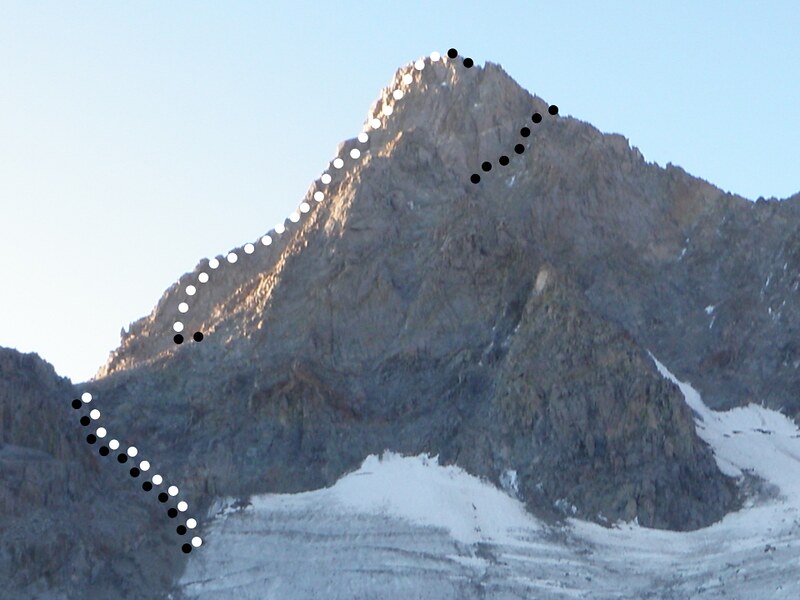
Mount Sill • Pitches
Mount Sill • Description
Mount Sill (14,154 ft) has arguably the best summit views in the Sierra Nevada, including the Palisade Cirque, Mount Ritter in the north, Mount Whitney in the south, and many imposing peaks of Kings Canyon National Park in the west. The guide book states: "You will enjoy a beautiful hike, a glacial experience, will have to cope with high-altitude, and then you will be one with the rocky ridge of the Palisades that contain seven of the fifteen 14,000 ft peaks in California."
The trailhead is located at Glacier Lodge (7,600 ft). North Fork Trail leads up to Sam Mack Meadow, passing First, Second, and Third Lake. Second Lake offers an amazing view of Temple Crag. At Sam Mack Meadow, the trail crosses Big Pine Creek and leads up a rocky ramp system to the base of the moraine.
Moraine Camp (11,400 ft) is located at Big Pine Creek and requires crossing the Palisade Glacier (ice axe and crampons are needed). Gayley Camp (11,900 ft) is located at the base of Mount Gayley and requires crossing large loose talus. Glacier Notch is a short loose gully. From its top, the L-shaped snowfield that marks the base of Mount Sill can be seen.
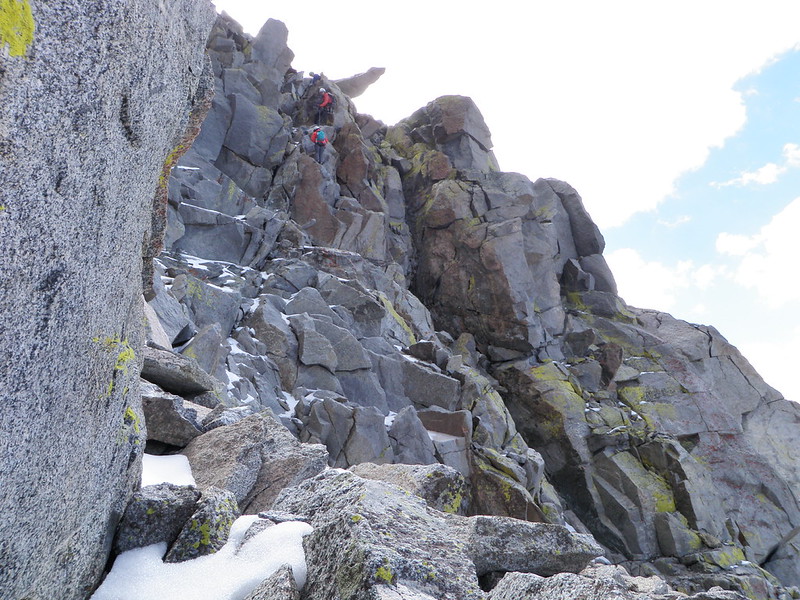
The Swiss Arête is composed of solid granite. Its crux, located in the middle of the route, requires a step around a corner, followed by an exposed hand crack. The Swiss Arête offers spectacular views of the Palisades, including Thunderbolt Peak, Starlight Peak, North Palisade, Polemonium Peak, Middle Palisade, and Split Mountain.
The descent leads over 3rd and 4th class terrain. Initially down the Southwest Ridge towards North Palisade, then down the North Face (rappel), and finally down the L-Couloir to the base of Mount Sill. Depending on conditions, ice axe and crampons are needed.
A permit is required.
Mount Sill • Interactive Map
Mount Sill • Pictures
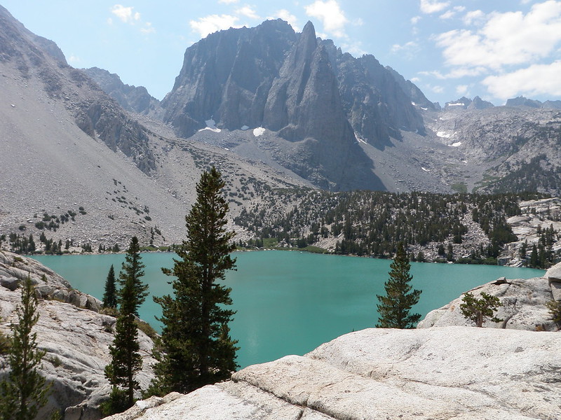
Temple Crag
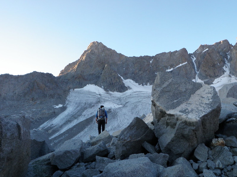
Mount Sill and Palisade Glacier
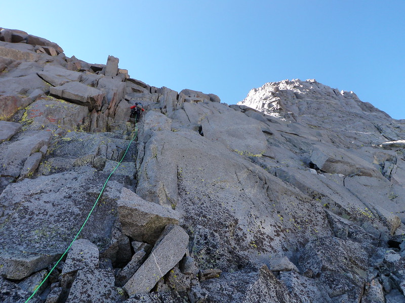
Swiss Arête Pitch 1
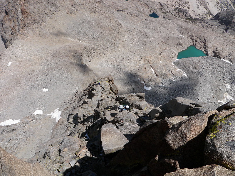
Swiss Arête Pitch 2
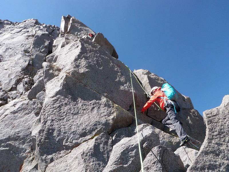
Swiss Arête Pitch 3
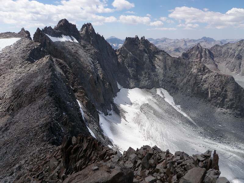
View from Mount Sill
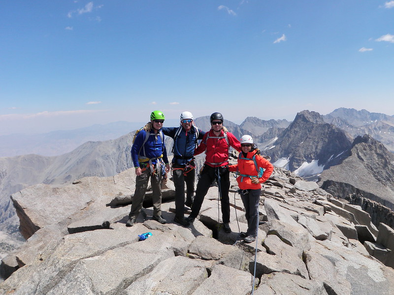
Mount Sill
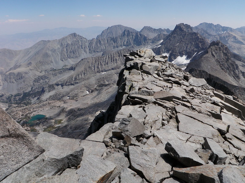
View from Mount Sill
North Face
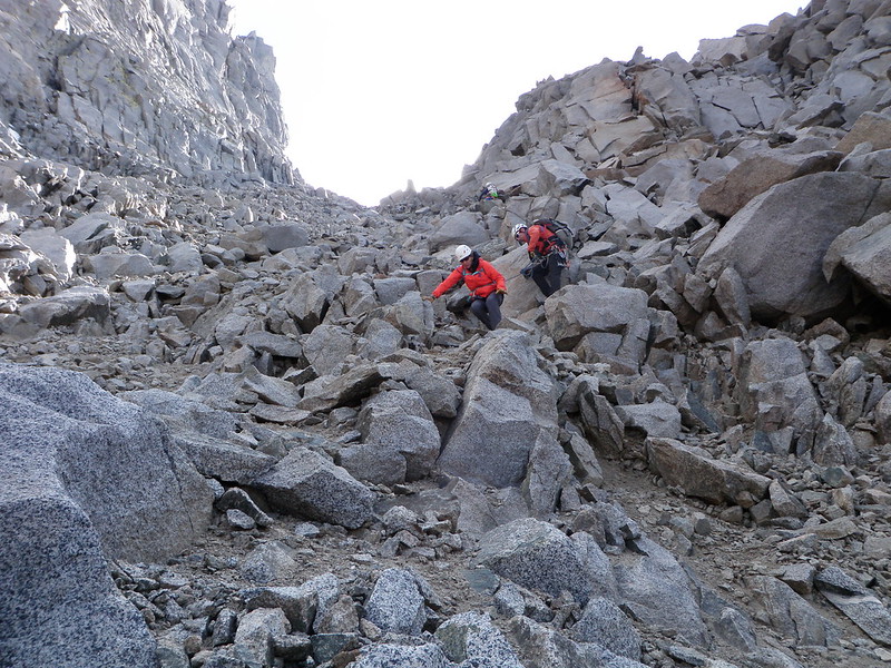
L-Couloir
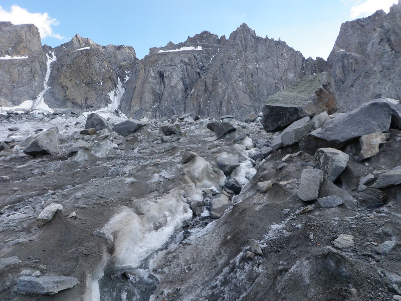
Palisade Glacier
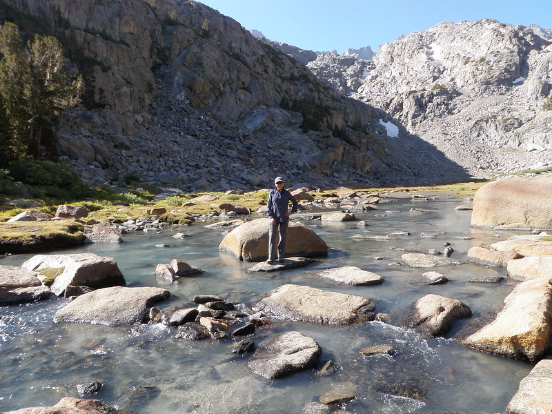
North Fork Big Pine Creek
By: Bernd Straehle
See Also: Climbing & Mountaineering